SPAN00GRC Site Information Form (site log)
International GNSS Service
See Instructions at:
https://files.igs.org/pub/station/general/sitelog_instr.txt
0. Form
Prepared by (full name) : NOA GNSS Team (gnss-noanet@noa.gr)
Date Prepared : 2024-06-26
Report Type : UPDATE
If Update:
Previous Site Log : span00grc_20240612.log
Modified/Added Sections : 3.4, 3.5
1. Site Identification of the GNSS Monument
Site Name : SPAN
Four Character ID : SPAN
Monument Inscription : NONE
IERS DOMES Number : 12628M001
CDP Number : (A4)
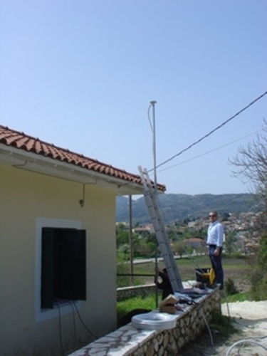
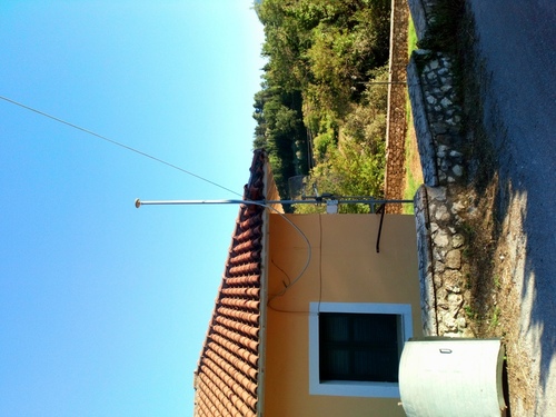
Monument Description : STEEL MAST
Height of the Monument : (m)
Monument Foundation : ROOF
Foundation Depth : (m)
Marker Description : (CHISELLED CROSS/DIVOT/BRASS NAIL/etc)
Date Installed : 2007-05-22T00:00Z
Geologic Characteristic : BEDROCK SANDSTONE
Bedrock Type : SEDIMENTARY
Bedrock Condition : JOINTED
Fracture Spacing : (0 cm/1-10 cm/11-50 cm/51-200 cm/over 200 cm)
Fault zones nearby : (YES/NO/Name of the zone)
Distance/activity : (multiple lines)
Additional Information : SPAN is operated by The National Observatory of
: Athens
2. Site Location Information
City or Town : Spanochori
State or Province : Lefkada Island
Country : Greece
Tectonic Plate : EURASIAN
Approximate Position (ITRF)
X coordinate (m) : 4658312.176
Y coordinate (m) : 1757780.776
Z coordinate (m) : 3973702.609
Latitude (N is +) : +384652.68
Longitude (E is +) : +0204025.10
Elevation (m,ellips.) : 451.3
Additional Information : (multiple lines)
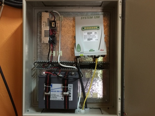
3. GNSS Receiver Information
3.1 Receiver Type : LEICA GRX1200PRO
Satellite System : GPS
Serial Number : 465460
Firmware Version : 5.10/3.013
Elevation Cutoff Setting : 10 deg
Date Installed : 2007-05-22T00:00Z
Date Removed : 2008-02-23T00:00Z
Temperature Stabiliz. : (deg C) +/- (deg C)
Additional Information : (multiple lines)
3.2 Receiver Type : LEICA GRX1200PRO
Satellite System : GPS
Serial Number : 462661
Firmware Version : 3.00/2.121
Elevation Cutoff Setting : 10 deg
Date Installed : 2008-03-27T00:00Z
Date Removed : 2012-12-11T23:59Z
Temperature Stabiliz. : (deg C) +/- (deg C)
Additional Information : (multiple lines)
3.3 Receiver Type : LEICA GRX1200PRO
Satellite System : GPS
Serial Number : 462661
Firmware Version : 3.00/2.127
Elevation Cutoff Setting : 10 deg
Date Installed : 2012-12-12T00:00Z
Date Removed : 2019-06-23T23:59Z
Temperature Stabiliz. : (deg C) +/- (deg C)
Additional Information : (multiple lines)
3.4 Receiver Type : LEICA GRX1200PRO
Satellite System : GPS
Serial Number : 462661
Firmware Version : 9.20/2.127
Elevation Cutoff Setting : 10 deg
Date Installed : 2019-06-24T00:00Z
Date Removed : 2024-03-21T00:00Z
Temperature Stabiliz. : (deg C) +/- (deg C)
Additional Information : (multiple lines)
3.5 Receiver Type : TRIMBLE NETRS
Satellite System : GPS
Serial Number : 4636121851
Firmware Version : 1.32
Elevation Cutoff Setting : 5 deg
Date Installed : 2024-03-21T00:00Z
Date Removed : CCYY-MM-DDThh:mmZ
Temperature Stabiliz. : (deg C) +/- (deg C)
Additional Information : (multiple lines)
3.x Receiver Type : (A20, from rcvr_ant.tab; see instructions)
Satellite System : (GPS+GLO+GAL+BDS+QZSS+IRNSS+SBAS)
Serial Number : (A20, but note the first A5 is used in SINEX)
Firmware Version : (A11)
Elevation Cutoff Setting : (deg)
Date Installed : (CCYY-MM-DDThh:mmZ)
Date Removed : (CCYY-MM-DDThh:mmZ)
Temperature Stabiliz. : (none or tolerance in degrees C)
Additional Information : (multiple lines)
4. GNSS Antenna Information
4.1 Antenna Type : LEIAX1202GG NONE
Serial Number : 06500017
Antenna Reference Point : BAM
Marker->ARP Up Ecc. (m) : 0.0000
Marker->ARP North Ecc(m) : 0.0000
Marker->ARP East Ecc(m) : 0.0000
Alignment from True N : 0 deg
Antenna Radome Type : NONE
Radome Serial Number :
Antenna Cable Type : (vendor & type number)
Antenna Cable Length : (m)
Date Installed : 2007-05-22T00:00Z
Date Removed : CCYY-MM-DDThh:mmZ
Additional Information : (multiple lines)
4.x Antenna Type : (A20, from rcvr_ant.tab; see instructions)
Serial Number : (A*, but note the first A5 is used in SINEX)
Antenna Reference Point : (BPA/BCR/XXX from "antenna.gra"; see instr.)
Marker->ARP Up Ecc. (m) : (F8.4)
Marker->ARP North Ecc(m) : (F8.4)
Marker->ARP East Ecc(m) : (F8.4)
Alignment from True N : (deg; + is clockwise/east)
Antenna Radome Type : (A4 from rcvr_ant.tab; see instructions)
Radome Serial Number :
Antenna Cable Type : (vendor & type number)
Antenna Cable Length : (m)
Date Installed : (CCYY-MM-DDThh:mmZ)
Date Removed : (CCYY-MM-DDThh:mmZ)
Additional Information : (multiple lines)
5. Surveyed Local Ties
5.x Tied Marker Name :
Tied Marker Usage : (SLR/VLBI/LOCAL CONTROL/FOOTPRINT/etc)
Tied Marker CDP Number : (A4)
Tied Marker DOMES Number : (A9)
Differential Components from GNSS Marker to the tied monument (ITRS)
dx (m) : (m)
dy (m) : (m)
dz (m) : (m)
Accuracy (mm) : (mm)
Survey method : (GPS CAMPAIGN/TRILATERATION/TRIANGULATION/etc)
Date Measured : (CCYY-MM-DDThh:mmZ)
Additional Information : (multiple lines)
6. Frequency Standard
6.1 Standard Type : INTERNAL
Input Frequency : (if external)
Effective Dates : 2004-06-15/CCYY-MM-DD
Notes : (multiple lines)
6.x Standard Type : (INTERNAL or EXTERNAL H-MASER/CESIUM/etc)
Input Frequency : (if external)
Effective Dates : (CCYY-MM-DD/CCYY-MM-DD)
Notes : (multiple lines)
7. Collocation Information
7.x Instrumentation Type : (GPS/GLONASS/DORIS/PRARE/SLR/VLBI/TIME/etc)
Status : (PERMANENT/MOBILE)
Effective Dates : (CCYY-MM-DD/CCYY-MM-DD)
Notes : (multiple lines)
8. Meteorological Instrumentation
8.1.x Humidity Sensor Model :
Manufacturer :
Serial Number :
Data Sampling Interval : (sec)
Accuracy (% rel h) : (% rel h)
Aspiration : (UNASPIRATED/NATURAL/FAN/etc)
Height Diff to Ant : (m)
Calibration date : (CCYY-MM-DD)
Effective Dates : (CCYY-MM-DD/CCYY-MM-DD)
Notes : (multiple lines)
8.2.x Pressure Sensor Model :
Manufacturer :
Serial Number :
Data Sampling Interval : (sec)
Accuracy : (hPa)
Height Diff to Ant : (m)
Calibration date : (CCYY-MM-DD)
Effective Dates : (CCYY-MM-DD/CCYY-MM-DD)
Notes : (multiple lines)
8.3.x Temp. Sensor Model :
Manufacturer :
Serial Number :
Data Sampling Interval : (sec)
Accuracy : (deg C)
Aspiration : (UNASPIRATED/NATURAL/FAN/etc)
Height Diff to Ant : (m)
Calibration date : (CCYY-MM-DD)
Effective Dates : (CCYY-MM-DD/CCYY-MM-DD)
Notes : (multiple lines)
8.4.x Water Vapor Radiometer :
Manufacturer :
Serial Number :
Distance to Antenna : (m)
Height Diff to Ant : (m)
Calibration date : (CCYY-MM-DD)
Effective Dates : (CCYY-MM-DD/CCYY-MM-DD)
Notes : (multiple lines)
8.5.x Other Instrumentation : (multiple lines)
9. Local Ongoing Conditions Possibly Affecting Computed Position
9.1.x Radio Interferences : (TV/CELL PHONE ANTENNA/RADAR/etc)
Observed Degradations : (SN RATIO/DATA GAPS/etc)
Effective Dates : (CCYY-MM-DD/CCYY-MM-DD)
Additional Information : (multiple lines)
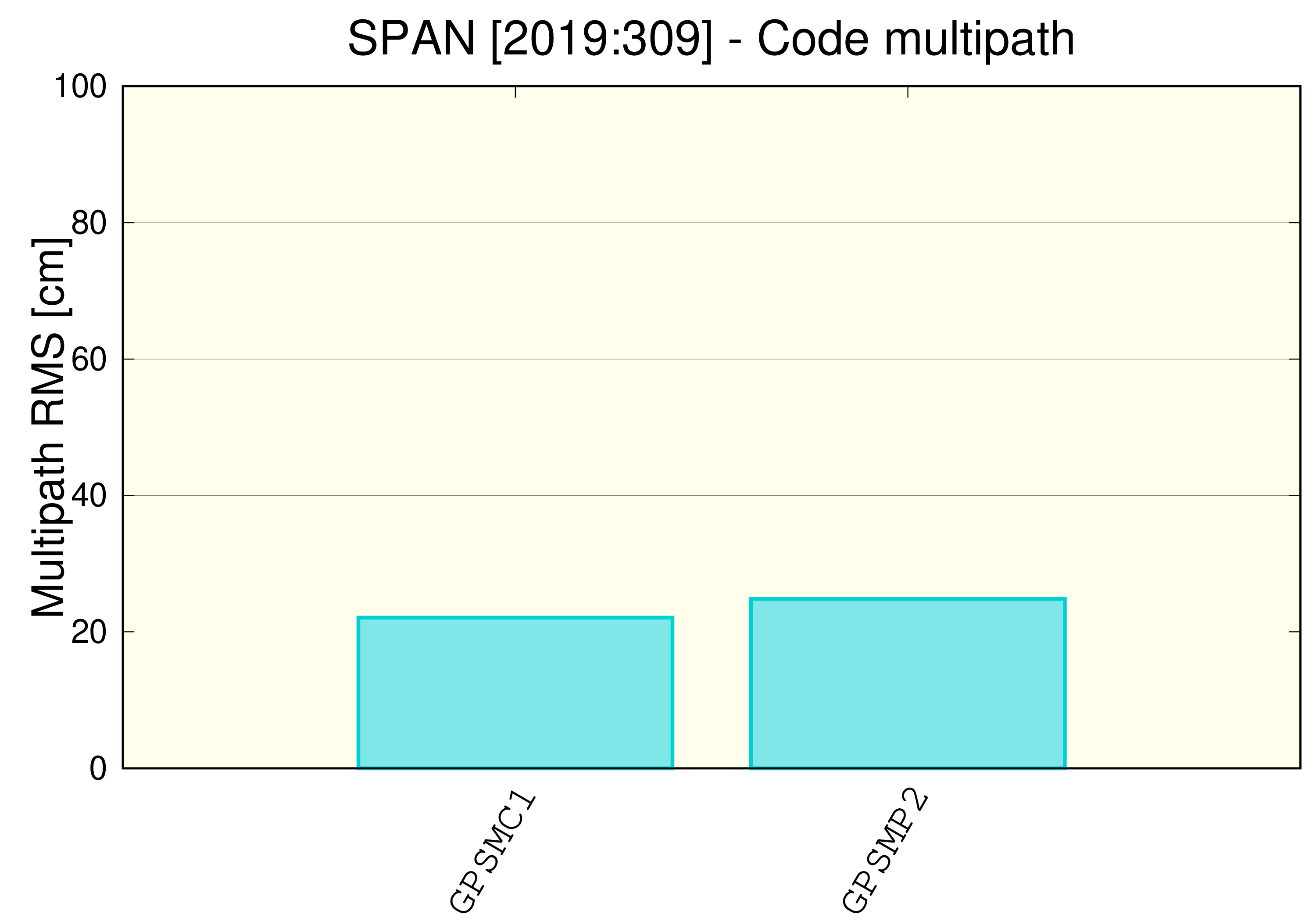
9.2.x Multipath Sources : (METAL ROOF/DOME/VLBI ANTENNA/etc)
Effective Dates : (CCYY-MM-DD/CCYY-MM-DD)
Additional Information : (multiple lines)
9.3.x Signal Obstructions : (TREES/BUILDINGS/etc)
Effective Dates : (CCYY-MM-DD/CCYY-MM-DD)
Additional Information : (multiple lines)
10. Local Episodic Effects Possibly Affecting Data Quality
10.x Date : (CCYY-MM-DD/CCYY-MM-DD)
Event : (TREE CLEARING/CONSTRUCTION/etc)
11. On-Site, Point of Contact Agency Information
Agency : National Observatory of Athens
: Institute of Geodynamics
Preferred Abbreviation : NOA
Mailing Address : Lofos Nymfon, Thission
: 11810 Athens
: Greece
Primary Contact
Contact Name : NOA GNSS Team
Telephone (primary) : +30 21 0349 0184
Telephone (secondary) :
Fax :
E-mail : gnss-noanet@noa.gr
Secondary Contact
Contact Name : Dr. Konstantinos Chousianitis
Telephone (primary) : +30 21 0349 0184
Telephone (secondary) :
Fax : +30 21 0349 0180
E-mail : chousianitis@noa.gr
Additional Information : (multiple lines)
12. Responsible Agency (if different from 11.)
Agency : (multiple lines)
Preferred Abbreviation : (A10)
Mailing Address : (multiple lines)
Primary Contact
Contact Name :
Telephone (primary) :
Telephone (secondary) :
Fax :
E-mail :
Secondary Contact
Contact Name :
Telephone (primary) :
Telephone (secondary) :
Fax :
E-mail :
Additional Information : (multiple lines)
13. More Information
Primary Data Center : NOA
Secondary Data Center :
URL for More Information :
Hardcopy on File
Site Map : (Y or URL)
Site Diagram : (Y or URL)
Horizon Mask : (Y or URL)
Monument Description : (Y or URL)
Site Pictures : (Y or URL)
Additional Information : (multiple lines)
Antenna Graphics with Dimensions
LEIAX1202GG
___---___ <-- 0.0620
/ \
/ \
/ \
+-----------------------------------------------+
+-----------------------------------------------+
\---------+ + + +---------/
=========
====x==== <-- 0.0000 BAM=ARP
RXC=NRP
<-- 0.1700 -->