NOANET
The Institute of Geodynamics (GEIN) of the National Observatory of Athens (NOA) operates the NOANET, which is a continuously operating GNSS network in Greece, for regional studies in seismology and geodynamics. Its primary scientific role is to support high precision, real-time geodetic measurements using Global Navigation Satellite System (GNSS) observations, in order to measure and quantify coseismic, postseismic, and interseismic deformation across major fault zones, active crustal deformation processes and tectonic deformation in the plate boundary zones of the eastern Mediterranean, as well as to support GPS seismology and other earth science applications. The NOANET network has been operating since 2006, following the EUREF Permanent GNSS Network (EPN) standards.
The network, as of September 2025, comprises 34 stations all of which are telemetered in real-time to the main GNSS server of the Institute of Geodynamics in Athens. All stations collect data every 1 sec and transmit them to Athens on the hour (hourly files). At some stations, 5 Hz or 10 Hz are also collected on the ring buffer and remain available for manual download for a period of 72 hours. Data archiving is performed in two modes:
- 1 sec data of each station are archived in hourly intervals and
- daily data for each station are archived in 30 sec sampling rate.
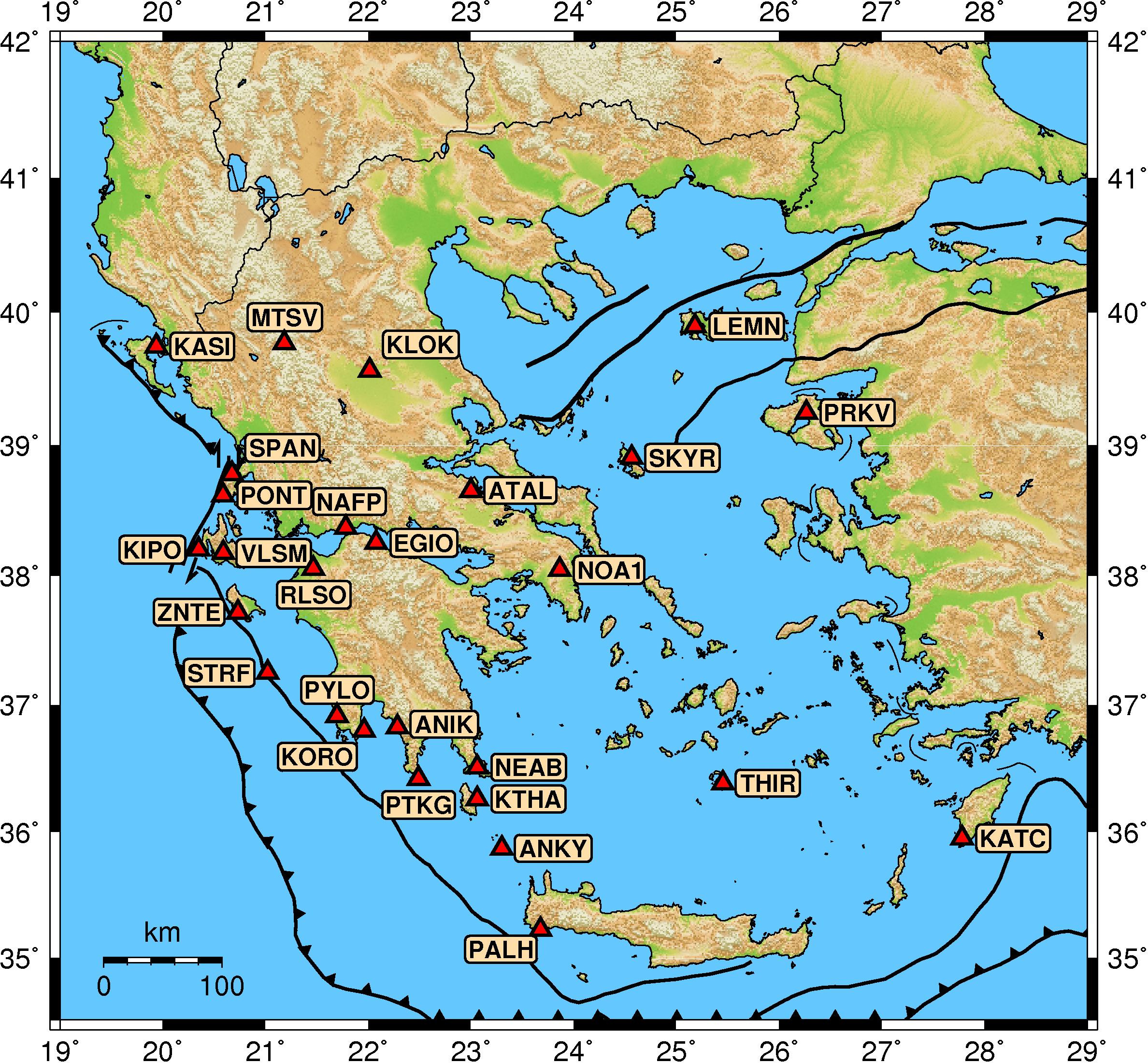
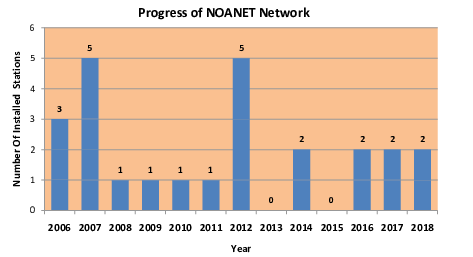
The first installation was completed in February 2006 in the island of Cephalonia, Ionian Sea and was named VLSM. This site is co-located with the NOA seismological station. The second station that operated was RLSO which was installed in the vicinity of the 8 June 2008 Achaia earthquake (Mw 6.4) at NW Peloponnese. Afterwards, station NOA1 was installed in March 2006 and since April 2006 is part of the EUREF Permanent GNSS Network (EPN). Subsequently, we focused in western Greece where stations PONT and SPAN were installed at the island of Lefkada, approximately 7 km to the east of the Cephalonia Transform Fault, and station KASI in northern Corfu island at about 35-25 km to the east of the Apulian thrust, a rather unexplored structure. Next, new GNSS stations were installed throughout central and southern Greece, as well as at north Aegean islands. During 2016-2018 within the framework of a bilateral cooperation under a Memorandum of Understanding with Istituto Nazionale di Geofisica e Vulcanologia (INGV), we installed stations STRF, KTHA, ANKY, PTKG and ZNTE at some of the most critical locations of SW Greece for capturing the active deformation of the western Hellenic Arc.
NOANET supports a free and open data policy. Data are provided to the Science community under the agreement that proper acknowledgements are made.
For any information concerning the NOANET network of the Institute of Geodynamics contact Dr. Konstantinos Chousianitis